
Our country India is a land of rich diversity and cultural heritage. It is a place where history meets modernity, and traditions blend seamlessly with progress. Our country India is known for its vast geographical expanse, which includes a variety of landscapes, from towering mountains to expansive plains, from lush forests to arid deserts. The beauty of India lies not just in its physical features but also in the unity among its diverse cultures, languages, and traditions.
- India is the seventh-largest country in the world.
- It has a population of over 1.3 billion people.
- India is home to 29 states and 7 Union territories.
- The country has a coastline stretching over 7,500 kilometers.
- The Indian subcontinent has diverse climatic zones.
| GS Paper | GS Paper I |
| Topics for UPSC Prelims | Physical features of India, Climate zones in India, Major rivers and natural resources in India |
| Topics for UPSC Mains | Socio-cultural diversity in India, Economic regions and industries in India, Environmental challenges in India |
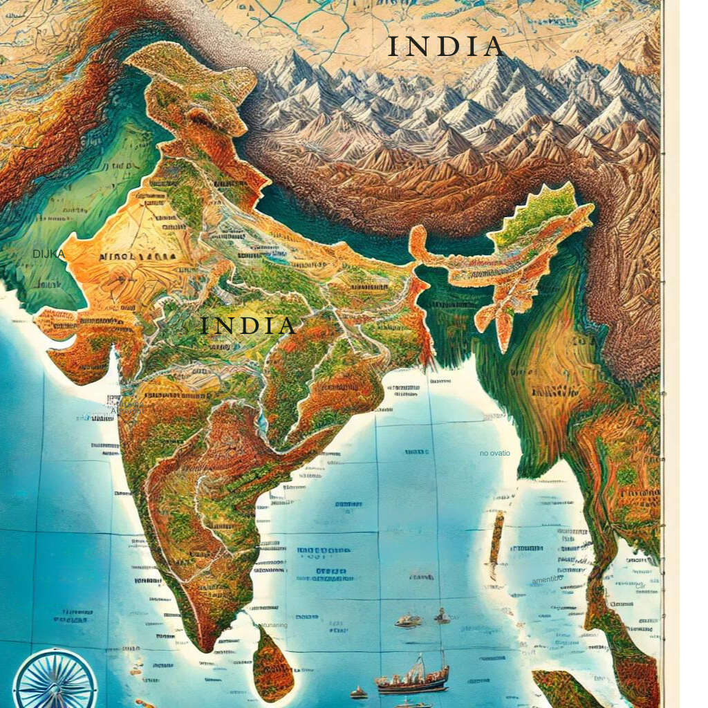
India’s Geographical Expanse
India’s Geographical Expanse covers an area of approximately 3.28 million square kilometers. This vast land area makes India the seventh-largest country in the world by total area. The country extends from the northernmost point in the state of Jammu and Kashmir to the southern tip of Kanyakumari. The longitudinal extent of India ranges from 68°7′ E to 97°25′ E, while the latitudinal extent stretches from 8°4′ N to 37°6′ N.
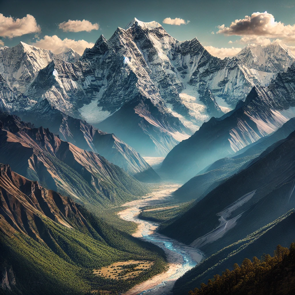
Northern Boundary: The Himalayas
The northern boundary of India is marked by the towering Himalayas, one of the world’s highest mountain ranges. These mountains form a natural barrier that has historically protected the Indian subcontinent from invasions. The Himalayas also influence the climate by blocking cold winds from Central Asia, contributing to the monsoon season, which is vital for India’s agriculture.
Eastern and Western Extents
Bangladesh and Myanmar border India to the east. Lush green forests and high rainfall characterize the eastern states, known as the Seven Sisters. The Thar Desert marks the western boundary of India, stretching across Rajasthan and extending into Pakistan.
Southern Peninsula
The southern part of India is a peninsula, surrounded by the Arabian Sea on the west, the Bay of Bengal on the east, and the Indian Ocean to the south. The southern tip of India, Kanyakumari, is a popular tourist destination known for its unique phenomenon where the Bay of Bengal, Arabian Sea, and Indian Ocean meet.
India’s Long Coastline
India’s coastline stretches over 7,500 kilometers, offering a diverse range of ecosystems, including mangroves, coral reefs, and beaches. The coastal regions are crucial for trade and commerce, with major ports like Mumbai, Chennai, and Kolkata facilitating international trade.
Physical Features of India
The physical features of India are diverse, ranging from the snow-capped peaks of the Himalayas to the fertile plains of the Indo-Gangetic basin, and from the arid deserts of Rajasthan to the lush tropical rainforests of the Western Ghats.
The Northern Mountains
It, comprising the Himalayas and their foothills, are among the most significant physical features of India. The Northern Mountains of India, including the Himalayas, are majestic and towering. They influence climate, house diverse ecosystems, and are vital for water resources, spirituality, and adventure tourism.
The Himalayan Ranges
The Himalayas are divided into three parallel ranges: the Greater Himalayas (Himadri), the Lesser Himalayas (Himachal), and the Outer Himalayas (Shiwaliks). The Himadri range includes some of the world’s highest peaks, such as Mount Everest and Kanchenjunga. These mountains are not only a natural barrier but also a source of major rivers like the Ganges, Yamuna, and Brahmaputra.
The Trans-Himalayan Region
Beyond the main Himalayan ranges lies the Trans-Himalayan region, which includes the Karakoram Range and the Ladakh Range. This region is known for its rugged terrain and cold desert conditions. The Siachen Glacier, one of the longest glaciers outside the polar regions, is located here.
The Ganga-Brahmaputra Plains
The Ganga-Brahmaputra Plains extend from the Punjab plains in the west to the Brahmaputra valley in the east. These plains are formed by the alluvial deposits brought by the rivers Ganga, Yamuna, and Brahmaputra. The region is densely populated and agriculturally productive, supporting crops like rice, wheat, and sugarcane.
The Punjab-Haryana Plains
The Punjab-Haryana Plains are located in the western part of the Northern Plains. These plains are formed by the Indus River and its tributaries, and they are known for their extensive irrigation and high agricultural productivity. The Green Revolution had a significant impact on this region, turning it into India’s “granary.”
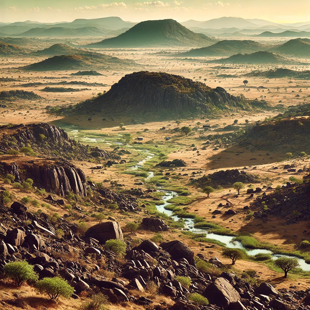
The Central Highlands
The Central Highlands are located to the north of the Peninsular Plateau, between the Aravalli Range and the Vindhya Range. This region features hilly terrain and contains rich mineral resources, including coal and iron ore.
The Deccan Plateau
The Deccan Plateau occupies most of the southern part of India. The Western Ghats border it on the west, and the Eastern Ghats border it on the east. People know the plateau for its unique volcanic soil, which is ideal for growing cotton. The region also has important rivers like the Godavari, Krishna, and Kaveri, which are lifelines for the local population.
The Western Coastal Plains
The Western Coastal Plains stretch from Gujarat to Kerala. A narrow strip of land lies between the Western Ghats and the Arabian Sea. People know this region for its beautiful beaches, backwaters, and rich biodiversity. The Konkan coast, which is part of these plains, is famous for its scenic beauty and vibrant culture.
The Eastern Coastal Plains
The Eastern Coastal Plains extend from West Bengal to Tamil Nadu, along the Bay of Bengal. This region is wider than the western coast and is home to the deltas of major rivers like the Mahanadi, Godavari, Krishna, and Kaveri. The Eastern Ghats run parallel to this coast, creating a unique landscape that includes fertile plains and hill ranges.
Economic Significance of India’s Geography
- Diverse Climate Zones: India’s varied climate zones support multiple agricultural crops, enhancing food security and export potential.
- Strategic Location: Positioned between the Middle East and Southeast Asia, India serves as a crucial trade hub connecting these regions.
- Rich Mineral Resources: Geographical diversity provides a wealth of minerals and resources, fueling industries and contributing to economic growth.
- Extensive Coastline: India’s long coastline facilitates major ports and maritime trade, bolstering its status as a global trading power.
- Rivers and Waterways: Major rivers like the Ganges and Brahmaputra support irrigation, agriculture, and hydroelectric power generation.
- Mountain Ranges: The Himalayas act as a natural barrier, impacting climate patterns and agricultural practices in northern India.
- Biodiversity Hotspot: Unique ecosystems promote tourism and the development of industries related to wildlife conservation and eco-tourism.
- Natural Harbors: Coastal cities with natural harbors, such as Mumbai and Chennai, enhance trade and industrial activities.
- Energy Resources: India’s geographical distribution of coal, oil, and natural gas fields supports energy security and industrial growth.
Conclusion
India stands as a vibrant and diverse nation, rich in cultural heritage and natural resources. Its geographical features—from the towering Himalayas to the extensive coastline—play a crucial role in shaping its economy and lifestyle. The country’s strategic location enhances its global trade, while its varied climate supports a range of agricultural activities. As India continues to evolve, its unique geography remains a key driver of its prosperity and development.
| Our Country India UPSC Notes |
| 1. India is a diverse country with varied landscapes, including mountains, deserts, plains, and coastal regions. 2. The Northern Mountains, including the Himalayas, play a crucial role in climate regulation and water resource availability. 3. The Thar Desert marks the western boundary of India and is characterized by extreme temperatures and sparse vegetation. 4. The fertile plains of India, especially the Indo-Gangetic Plain, support a significant portion of the population and agriculture. 5. The eastern states, known as the Seven Sisters, are lush with green forests and receive high rainfall. 6. India’s coastline, stretching over 7,500 kilometers, supports rich biodiversity and is crucial for trade and tourism. 7. The Deccan Plateau, known for its volcanic soil, is ideal for growing cotton and other crops. 8. India shares borders with several countries, including Bangladesh, Myanmar, Pakistan, and China, impacting its geopolitical dynamics. |