Landforms due to glaciers are unique features on Earth’s surface shaped by the slow movement of glaciers. These massive rivers of ice sculpt the land as they advance and retreat, carving out valleys, shaping mountains, and creating distinct depositional formations. Understanding these landforms helps us comprehend the immense power of glaciers and their role in shaping the Earth’s topography over thousands of years. It also provides insights into climate change, as these landforms record past glacial periods and interglacial warming phases.
- Glaciers move slowly but have a significant impact on the landscape.
- They carve out valleys, create ridges, and leave behind distinctive deposits.
- Glacial landforms offer clues about past climates and geological processes.
- These features are crucial for studying Earth’s history and environment.
Erosional Landforms Due to Glaciers
Glaciers, as they move, erode the land beneath them, creating a variety of unique landforms. These landforms due to glaciers can be striking and easily recognizable in areas that have experienced extensive glaciation.
U-shaped Valleys
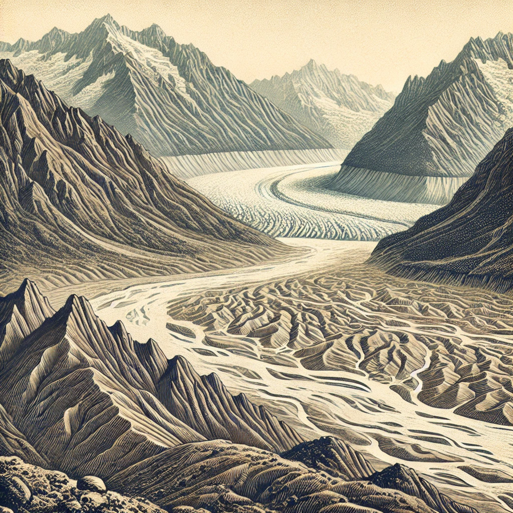
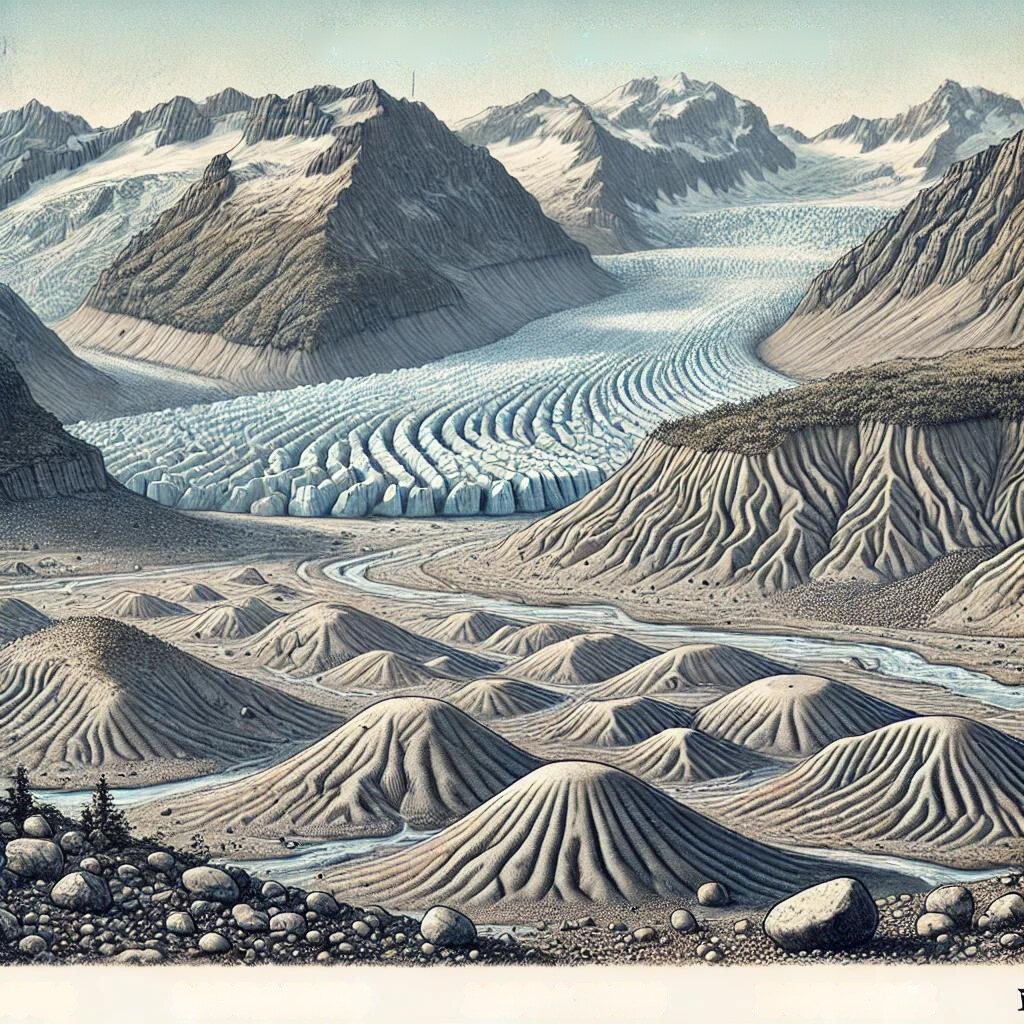
U-shaped valleys, also known as glacial troughs, are one of the most distinct features of glaciated landscapes. These valleys are formed when a glacier erodes a river valley, which usually has a V-shape, into a U-shape. The glacier’s immense weight and movement widen and deepen the valley, leaving behind steep sides and a flat floor. These valleys are prominent in mountainous regions where glaciers have carved through the terrain.
Cirques
Cirques are amphitheater-shaped hollows found at the heads of glacial valleys. They are formed by the erosion of the glacier as it plucks away material from the mountain. Over time, the cirque deepens and becomes a bowl-like depression. Cirques often contain small lakes called tarns, which are formed by the melting ice. The landforms due to glaciers such as cirques are common in high-altitude mountain ranges.
Aretes and Horns
Aretes are sharp ridges that form between two glacial valleys. They are the result of the erosion of two parallel glaciers that carve out adjacent valleys, leaving a narrow, knife-edge ridge. Horns, on the other hand, are sharp, pyramid-shaped peaks formed by the erosion of three or more cirques converging on a single mountain. The Matterhorn in the Alps is one of the most famous examples of a horn.
Fjords
Fjords are deep, narrow sea inlets formed by the flooding of glacial valleys. When glaciers retreat, the valleys they carve out are often below sea level, allowing seawater to fill them. Fjords are characterized by steep cliffs that rise from the water, and they are commonly found in Norway, New Zealand, and Chile. The landforms due to glaciers such as fjords are significant for their dramatic scenery and economic importance, especially for tourism and fishing industries.
Depositional Landforms Due to Glaciers
As glaciers move, they not only erode the landscape but also deposit vast amounts of material. These depositional landforms due to glaciers upsc include a variety of features formed from the debris that glaciers leave behind.
Moraines
Moraines are accumulations of rock, soil, and other debris that have been transported by a glacier. There are several types of moraines:
- Lateral Moraines: Found along the sides of a glacier.
- Medial Moraines: Formed when two glaciers merge, and their lateral moraines combine.
- Terminal Moraines: Deposited at the furthest point reached by the glacier.
- Ground Moraines: Formed from debris deposited beneath the glacier.
Drumlins
Drumlins are smooth, elongated hills formed by the reshaping of glacial debris. They are typically found in groups called drumlin fields and indicate the direction of glacier movement. The long axis of a drumlin is parallel to the flow of the glacier, and its tapered end points in the direction of movement. Drumlins are among the most studied landforms due to glaciers because they reveal the dynamics of glacial movement.
Eskers
Eskers are long, winding ridges of sand and gravel that were deposited by streams running beneath a glacier. As the glacier melts, these streambeds become exposed, leaving behind ridges that can stretch for kilometers. Eskers provide important clues about the subglacial environment and the flow of meltwater during glaciation.
Kames and Kettles
Kames are irregularly shaped hills or mounds formed from sand and gravel that accumulate in depressions on a glacier’s surface or at the base of a melting glacier. When the glacier retreats, these deposits are left behind, forming small hills. Kettles, on the other hand, are depressions or holes left when blocks of ice become buried in glacial debris and then melt, creating small lakes or ponds.
Significance of Glacial Landforms
Landforms due to glaciers are not just geological features; they have significant implications for understanding Earth’s history and future. They serve as indicators of past climate conditions and help scientists predict future changes. The study of these depositional landforms due to glaciers upsc is crucial for aspiring geologists and geographers.
Climate Indicators
Glacial landforms are excellent indicators of past climates. For instance, the presence of moraines far from existing glaciers suggests that the area was once much colder, allowing glaciers to extend further. By studying these landforms, scientists can reconstruct past climate conditions and understand the extent of glaciation during different periods.
Water Resources
Glacial landforms also play a crucial role in water resources. Many of the world’s rivers originate from glaciers, and as these glaciers melt, they provide a steady supply of freshwater. Understanding landforms due to glaciers can help in managing these vital water resources, especially in regions where glaciers are shrinking due to global warming.
Natural Hazards
While glaciers and their landforms can be beautiful, they can also pose hazards. For example, the sudden melting of glaciers can lead to glacial lake outburst floods (GLOFs), which can cause significant damage downstream. Understanding the depositional landforms due to glaciers upsc can help in predicting and mitigating these natural hazards.
Conclusion
Studying landforms due to glaciers offers valuable insights into the powerful processes that have shaped our planet. These landforms tell the story of Earth’s glacial past, from towering U-shaped valleys to subtle drumlins. They are not only significant for understanding the Earth’s history but also for predicting future changes in our climate and environment. For students and professionals alike, mastering the knowledge of depositional landforms due to glaciers UPSC is essential for understanding the intricate connections between glaciers, landforms, and the environment. By studying these features, we gain a deeper appreciation of the dynamic and ever-changing nature of our planet.
| Landforms Due to Glaciers UPSC Notes |
| 1. Glaciers carve out distinctive landforms through processes like erosion, transportation, and deposition. 2. Cirques are amphitheater-like hollows formed by the headward erosion of glaciers. 3. Moraines are accumulations of glacial debris, forming ridges along glacier margins. 4. U-shaped valleys are formed by glacial erosion, contrasting with V-shaped valleys formed by rivers. 5. Horns are sharp mountain peaks created by the erosion of multiple cirques around a single summit. 6. Drumlins are elongated hills formed by glacial deposition, indicating the direction of ice movement. 7. Eskers are long, winding ridges formed by sediment deposition from meltwater streams within glaciers. 8. Glacial till refers to the unsorted mixture of materials deposited directly by glacier ice. |