
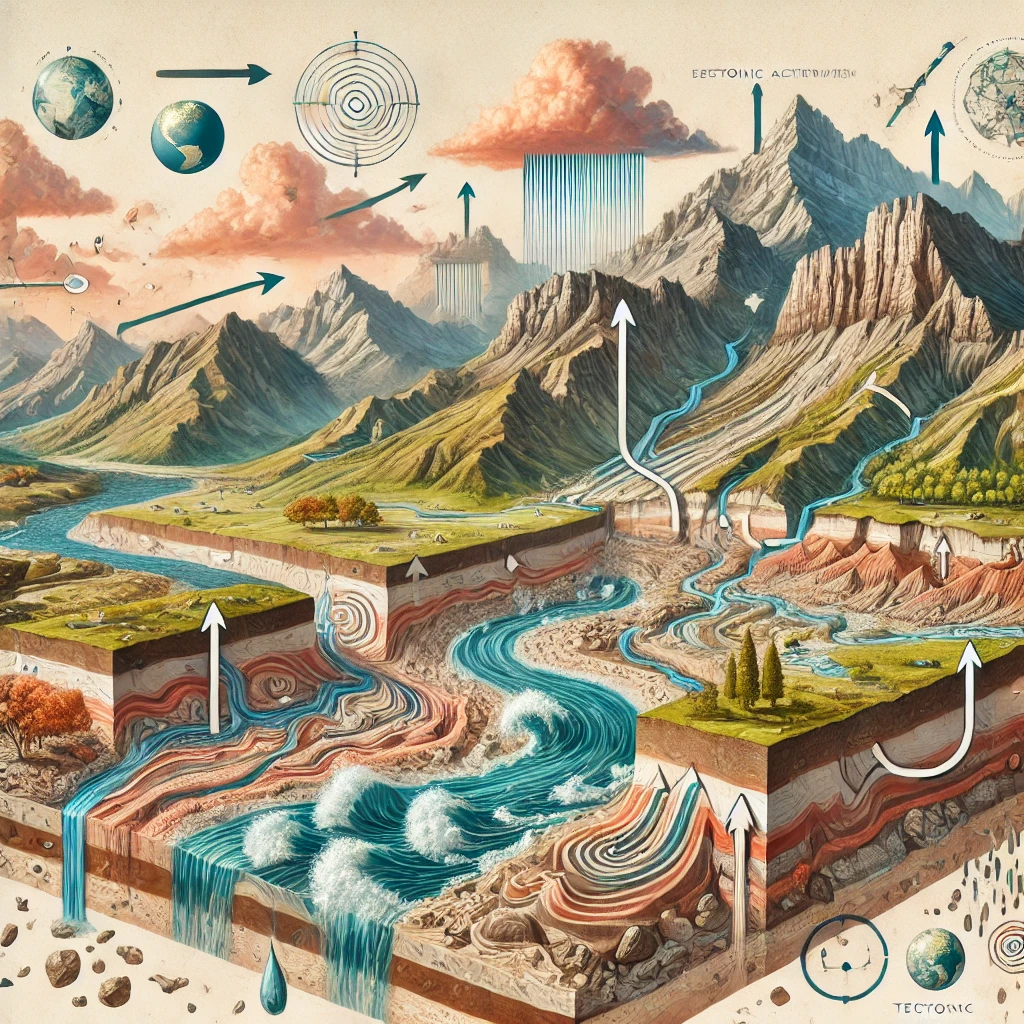
Geomorphic processes refer to the natural mechanisms that result in the formation, alteration, and destruction of landforms on the Earth’s surface. These processes are responsible for shaping the physical landscape of our planet. Understanding these processes is essential for comprehending the dynamic nature of the Earth’s crust and the factors that influence landform development and modification.
Studying geomorphic processes helps in understanding past and present landscape evolution, predicting future changes, managing natural resources, and mitigating natural hazards.
Types of Geomorphic Processes
Geomorphic processes are broadly categorized into Endogenic (internal) and Exogenic (external) processes.
Endogenic Processes
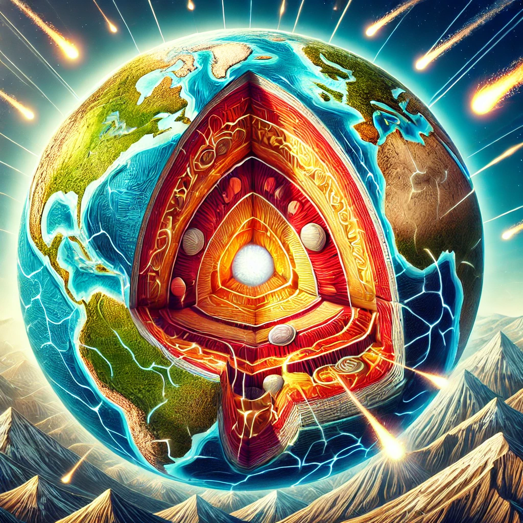
These processes originate from within the Earth and are driven by internal energy sources such as radioactive decay and gravitational forces. Endogenic processes generally create new landforms and significant changes in the Earth’s crust.
Examples: Volcanism, tectonic movements, earthquakes, and mountain-building processes (orogenesis).
Exogenic Processes
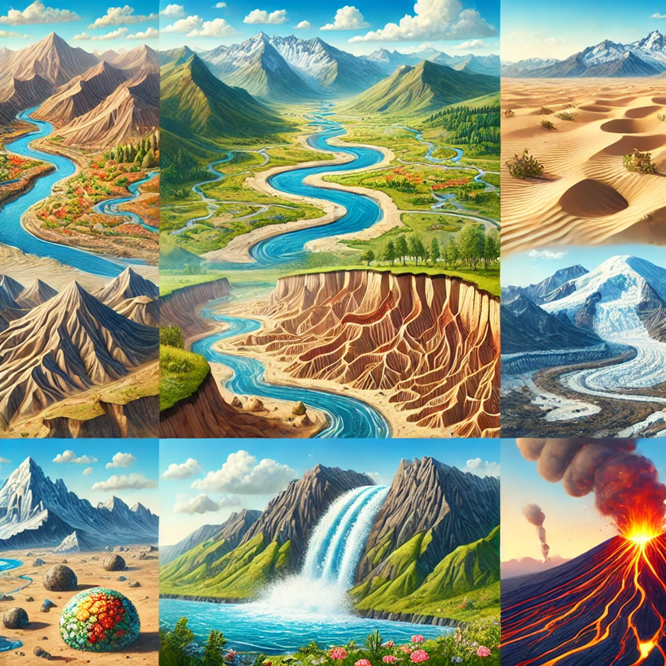
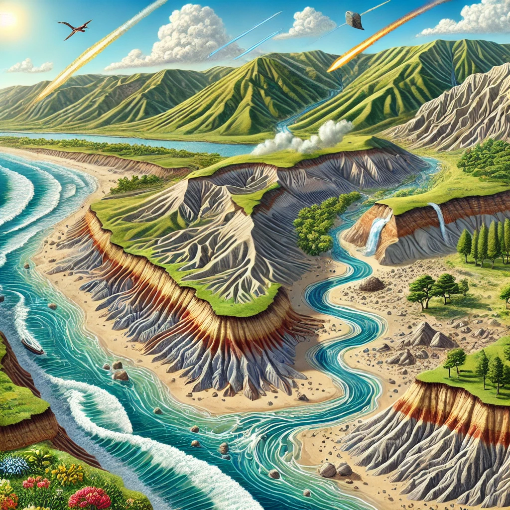
- These processes are driven by external forces, primarily solar energy and gravitational forces, and operate at or near the Earth’s surface. Exogenic processes tend to modify existing landforms through weathering, erosion, transportation, and deposition.
- Examples: Weathering (physical, chemical, biological), mass wasting, fluvial processes, glacial processes, aeolian (wind) processes, and coastal processes.
Difference Between Endogenic and Exogenic Processes
| Aspect | Endogenic Processes | Exogenic Processes |
| Definition | Processes originating within the Earth | Processes originating at or near the Earth’s surface |
| Energy Source | Internal energy from the Earth’s interior | External energy from the Sun, gravity, and atmospheric forces |
| Types of Processes | Volcanism, tectonism, and metamorphism | Weathering, erosion, transportation, and deposition |
| Examples of Landforms | Mountains, volcanoes, plateaus | Valleys, deltas, dunes |
| Impact on Earth’s Surface | Constructive, creates new landforms | Destructive, breaks down landforms |
| Geographical Distribution | Occur primarily at plate boundaries | Affect all parts of the Earth’s surface |
| Associated Hazards | Earthquakes, volcanic eruptions | Floods, landslides, coastal erosion |
Key Concepts in Geomorphic Processes
- Energy Sources: The driving forces behind geomorphic processes include the Earth’s internal heat, solar radiation, and gravity. These energy sources influence the intensity and type of geomorphic activity.
- Gradation: The process by which the Earth’s surface is leveled or graded through erosion and deposition. It includes both degradation (wearing down of landforms) and aggradation (building up of landforms).
- Dynamic Equilibrium: Geomorphic systems often operate in a state of dynamic equilibrium where the processes of uplift and erosion balance each other, maintaining a relatively stable landscape over geological time scales.
Examples of Geomorphic Processes
- Volcanism: The eruption of magma onto the Earth’s surface, forming volcanic landforms such as lava plains, shield volcanoes, and composite volcanoes.
- Weathering: The breakdown of rocks into smaller particles through physical disintegration, chemical decomposition, and biological activity.
- Erosion and Transportation: The removal and movement of weathered materials by agents such as water, wind, ice, and gravity.
- Deposition: The accumulation of sediments in new locations, leading to the formation of features such as deltas, alluvial fans, and dunes.
Endogenic Processes
Endogenic processes are a type of geomorphic processes that originate within the Earth and are responsible for creating various landforms. These processes are driven by the energy emanating from the Earth’s interior, mainly due to the heat generated by the radioactive decay of elements and the residual heat from the planet’s formation. Endogenic processes include diastrophism, volcanism, and earthquakes.
Diastrophism
Diastrophism is an endogenic geomorphic process that refers to the deformation of the Earth’s crust due to tectonic forces. It involves both vertical and horizontal movements of the Earth’s crust, leading to the formation of various structural features.
Orogenic Movements (Mountain Building)
- Folding: This occurs when horizontal compressional forces act upon the Earth’s crust, causing it to buckle and fold. This process leads to the formation of fold mountains such as the Himalayas and the Alps.
- Faulting: When the Earth’s crust cannot fold, it breaks and displaces along fractures called faults. This can result in the formation of block mountains and rift valleys. Examples include the Sierra Nevada mountains and the East African Rift Valley.
- Thrusting: Intense compressional forces can push one part of the crust over another, creating thrust faults. This often contributes to the formation of complex mountain ranges.
Epeirogenic Movements (Continent Building)
- Upwarping (Uplift): This involves the gradual lifting of large parts of the Earth’s crust. It can result in the formation of plateaus and elevated regions without significant folding or faulting. An example is the Deccan Plateau in India.
- Downwarping (Subsidence): The downward bending of the Earth’s crust can create basins and depressions. The formation of the Great Basin in the United States is an example of subsidence.
Volcanism
Volcanism encompasses all the endogenic geomorphic processes through which magma (molten rock) and associated gases and ash are expelled from the Earth’s interior to its surface. It results in various volcanic landforms and contributes to the renewal of the Earth’s crust.
Types of Volcanic Eruptions
- Effusive Eruptions: These are characterized by the outpouring of low-viscosity lava that flows easily, forming broad, gently sloping shield volcanoes like Mauna Loa in Hawaii.
- Explosive Eruptions: These eruptions are more violent due to the high viscosity of the magma, which traps gases until pressure builds up and is released explosively. This type of eruption forms steep-sided stratovolcanoes or composite volcanoes, such as Mount St. Helens and Mount Vesuvius.
Volcanic Landforms
- Shield Volcanoes: These have broad, dome-shaped profiles with gentle slopes, formed by low-viscosity lava.
- Composite Volcanoes: These have steep profiles and are composed of alternating layers of lava, ash, and other volcanic debris.
- Cinder Cones: These are small, steep-sided volcanoes formed from tephra (volcanic fragments) that fall around a vent.
- Calderas: Large, basin-like depressions formed when a volcano erupts and collapses.
Earthquakes
Earthquakes are one of the most significant endogenic geomorphic processes. They are caused by the sudden release of energy in the Earth’s crust, resulting in seismic waves that can cause substantial ground shaking and deformation. Understanding earthquakes involves exploring their causes, effects, and the geomorphic changes they induce.
Causes of Earthquakes
- Tectonic Movements: The most common cause of earthquakes is the movement of tectonic plates, which can be convergent, divergent, or transform.
- Volcanic Activity: Earthquakes can also occur due to volcanic eruptions, as magma movement can create stress within the Earth’s crust.
- Human Activities: Activities such as mining, reservoir-induced seismicity from large dams, and geothermal energy extraction can also trigger earthquakes.
Effects of Earthquakes
- Primary Effects: These include ground shaking, surface rupture, and ground displacement.
- Secondary Effects: These include landslides, tsunamis, fires, and soil liquefaction.
Exogenic Processes
The exogenic process is a type of geomorphic processes that occur on the Earth’s surface due to external forces, primarily driven by the energy from the sun and gravitational forces. These processes are responsible for shaping the landscape through weathering, erosion, transportation, and deposition. Here is a detailed explanation of the various aspects of exogenic processes:
Weathering
Weathering is the breakdown of rocks, soils, and minerals through contact with the Earth’s atmosphere, water, and biological organisms. It is a critical initial step in the formation of sediments. Here’s an overview of weathering, with a focus on the role of endogenic geomorphic processes.
Types of Weathering:
Physical (Mechanical) Weathering: Breakdown of rocks without changing their chemical composition. Processes include:
- Freeze-Thaw Weathering: Water enters cracks in rocks, freezes, expands, and eventually breaks the rock apart.
- Thermal Expansion: Repeated heating and cooling cause rocks to expand and contract, leading to fractures.
- Exfoliation: Outer layers of rocks peel away due to pressure release.
Chemical Weathering: Decomposition of rocks due to chemical reactions. Processes include:
- Oxidation: Reaction of rock minerals with oxygen, causing rusting in iron-rich rocks.
- Hydrolysis: Reaction with water, leading to the formation of new minerals like clays.
- Carbonation: Reaction with carbonic acid (from CO2 dissolved in water), affecting limestone and marble.
Biological Weathering: Breakdown of rocks by biological activity. Processes include:
- Root Expansion: Plant roots grow into rock cracks and force them apart.
- Lichen and Moss Growth: Organisms secrete acids that chemically weather rocks.
Mass Movements
Mass movements, also known as mass wasting, refer to the downslope movement of soil, rock, and debris under the influence of gravity. This geomorphic process plays a significant role in shaping landscapes by transporting materials from higher elevations to lower areas. Mass movements are classified based on the type of material involved and the nature of the movement.
Types of Mass Movements
Slow Movements:
- Soil Creep: Gradual downslope movement of soil and rock.
- Solifluction: Slow, water-saturated soil flow over impermeable surfaces.
Rapid Movements:
- Landslides: Sudden movement of rock and soil down a slope.
- Rockfalls: Freefall of rock from steep slopes.
Erosion, Transportation, and Deposition
These processes involve the removal, movement, and accumulation of sediment. Different agents, including water, wind, glaciers, and waves, play roles in these processes.
Agents of Erosion:
Water (Fluvial Processes):
- River Erosion: Includes hydraulic action, abrasion, and solution.
- River Transportation: Carried out through suspension, saltation, traction, and solution.
- River Deposition: Formation of landforms like alluvial fans, deltas, and floodplains.
Wind (Aeolian Processes):
- Wind Erosion: Deflation (lifting of loose particles) and abrasion (wearing down of surfaces).
- Wind Transportation: Suspension, saltation, and surface creep.
- Wind Deposition: Formation of dunes and loess deposits.
Glaciers (Glacial Processes):
- Glacial Erosion: Plucking and abrasion by moving ice.
- Glacial Transportation: Movement of debris within the ice.
- Glacial Deposition: Formation of moraines, drumlins, and eskers.
·Waves (Coastal Processes):
- Wave Erosion: Hydraulic action, abrasion, and solution along coastlines.
- Wave Transportation: Longshore drift and beach drift.
- Wave Deposition: Formation of beaches, spits, and barrier islands.
Denudation
Denudation encompasses all exogenic geomorphic processes that cause the wearing away of the Earth’s surface, leading to a reduction in elevation and relief.
Processes Involved in Denudation
- Weathering: Breakdown of rocks at the Earth’s surface.
- Erosion: Removal of surface material by agents like water, wind, and ice.
- Mass Wasting: Movement of weathered material downslope under gravity.
- Transportation: Movement of eroded material by natural agents.
- Deposition: Accumulation of transported material in new locations.
Significance of Exogenic Geomorphic Processes
- Landscape Formation: These processes shape various landforms, including valleys, mountains, plains, and coastal features.
- Soil Formation: Weathering contributes to the formation of soil, essential for plant growth.
- Nutrient Cycling: Breaking down rocks releases essential nutrients into the ecosystem.
- Natural Hazards: Processes like landslides, floods, and coastal erosion can pose risks to human life and infrastructure.
- Resource Distribution: Erosion and deposition influence the distribution of minerals and other geological resources.
Major Theories and Models in Geomorphology
Geomorphology, the study of landforms and the processes that shape them has developed several key theories and models to explain the geomorphic processes at work. Here are some of the major theories and models:
Continental Drift Theory
The Continental Drift Theory, proposed by Alfred Wegener in 1912, posits that the continents were once a single supercontinent called Pangaea, which gradually broke apart and drifted to their current positions. This theory laid the foundation for the later development of Plate Tectonics Theory. Here are the key components and geomorphic processes associated with the Continental Drift Theory
- Proponent: Alfred Wegener (1912)
- Concept: The theory suggests that the continents were once a single supercontinent called Pangaea, which later drifted apart.
Evidence
- Jigsaw Fit: The coastlines of continents such as South America and Africa appear to fit together like pieces of a jigsaw puzzle.
- Fossil Correlation: Identical fossils found on widely separated continents (e.g., Mesosaurus in South America and Africa).
- Rock Formations: Similar rock structures and mountain ranges are found on continents that are now far apart (e.g., the Appalachian Mountains in North America and the Caledonian Mountains in Scotland).
- Paleoclimatic Evidence: Evidence of glacial deposits in now tropical regions and coal beds in now cold regions suggesting these continents were once situated in different climatic zones.
Mechanism
Wegener proposed that the continents moved through the oceanic crust, plowing through the sea floor. This mechanism was later found to be incorrect.
Plate Tectonics Theory
The Plate Tectonics Theory is a unifying model that explains the movement of Earth’s lithosphere, which is divided into several large and small tectonic plates. Here are the key components and geomorphic processes associated with Plate Tectonics Theory.
- Development: Evolved from the Continental Drift Theory in the 1960s, incorporating the concept of sea-floor spreading proposed by Harry Hess.
- Concept: The Earth’s lithosphere is divided into several plates that float on the semi-fluid asthenosphere beneath. These plates move due to convection currents in the mantle.
Types of Plate Boundaries:
- Divergent Boundaries: Plates move apart, creating new crust (e.g., Mid-Atlantic Ridge).
- Convergent Boundaries: Plates move towards each other, leading to subduction or continental collision (e.g., the Himalayas formed by the collision of the Indian and Eurasian plates).
- Transform Boundaries: Plates slide past each other horizontally (e.g., the San Andreas Fault in California).
Mechanism
The movement is driven by mantle convection, slab pull, and ridge push.
Evidence
- Sea-Floor Spreading: Observed at mid-ocean ridges where new crust is formed.
- Magnetic Stripes: Symmetrical magnetic stripes on the ocean floor indicate periodic reversals of Earth’s magnetic field.
- Earthquake Distribution: Earthquakes and volcanic activity are concentrated along plate boundaries.
- GPS Measurements: Direct measurement of plate movements.
Cycle of Erosion
The concept of the “cycle of erosion” has been a foundational idea in geomorphology, describing the sequential stages of landscape development from initial uplift to ultimate denudation. Several geomorphologists have contributed to this concept, each adding their perspectives and refinements. Here are the major theories and models in geomorphology related to the cycle of erosion:
Proponents
William Morris Davis (late 19th and early 20th century), Walther Penck (early 20th century).
Davisian Model
The Davisian model of geomorphic processes, also known as the Geographical Cycle or Cycle of Erosion, was developed by William Morris Davis in the late 19th and early 20th centuries. This model provides a framework for understanding the evolution of landscapes over geological periods.
- Stages: Youth, Maturity, Old Age
- Youth: Characterized by steep gradients, V-shaped valleys, and active downcutting by rivers.
- Maturity: Features wider valleys, meanders, and well-developed floodplains.
- Old Age: Dominated by wide, flat plains with slow-moving rivers and extensive sediment deposition.
- Concept: Landscapes evolve predictably through these stages under the influence of fluvial processes.
Penck’s Model
- Concept: Emphasizes the role of tectonic uplift and its interaction with erosion. Suggests a more dynamic and continuous process compared to Davis’s model.
- Process: Erosion and uplift occur simultaneously, and the landscape is continuously evolving rather than passing through distinct stages.
- Landforms: Highlighted the importance of slope retreat and parallel slope retreat, leading to the development of pediments and inselbergs.
Impact of Geomorphic Processes on Human Activities
The impact of geomorphic processes on human activities is significant and multifaceted. These processes shape the physical environment in which humans live, influencing various aspects of life and society. Here is a detailed explanation of this impact:
Agriculture
Geomorphic processes affect soil formation, fertility, and distribution, which are critical for agriculture:
- Weathering: The breakdown of rocks into soil provides essential nutrients for crops.
- Erosion: Can both positively and negatively impact agriculture. While it can deposit fertile silt on floodplains, it can also strip away topsoil, reducing soil fertility.
- Landforms: Different landforms like plains, valleys, and plateaus offer varied agricultural potential. River valleys, for instance, are often highly fertile and suitable for intensive farming.
Settlement Patterns
Geomorphic processes often influence the human settlement’s characteristics of a region:
- Floodplains and River Valleys: Historically, these areas have been preferred for settlements due to fertile soil and access to water.
- Mountainous Regions: Settlement is less dense due to harsh terrain and limited agricultural potential. However, these areas may attract populations due to resources like minerals.
- Coastal Areas: Attract settlements due to the benefits of maritime trade, fishing, and tourism, despite the risks of erosion and tsunamis.
Infrastructure Development
Geomorphic processes significantly impact the planning and development of infrastructure:
- Road and Railway Construction: Requires careful consideration of landforms. For example, constructing in mountainous areas involves tunneling and bridge-building.
- Urban Planning: Geomorphology guides the placement of buildings and other infrastructure to avoid natural hazards such as floods and landslides.
- Dams and Reservoirs: Built on rivers influenced by geomorphic processes, their location, and design are crucial for water management and flood control.
Natural Disasters
Geomorphic processes are closely linked to various natural hazards that affect human life and activities:
- Earthquakes: Caused by tectonic movements, leading to loss of life, property damage, and economic disruption.
- Volcanic Eruptions: Can devastate nearby settlements, disrupt air travel, and impact climate patterns.
- Landslides: Often occur in hilly or mountainous regions, posing risks to settlements and infrastructure.
- Floods: Result from river dynamics and heavy rainfall, affecting vast areas, particularly in floodplains.
Economic Activities
Geomorphic processes shape the resources available for various economic activities:
- Mining: Geomorphic processes such as tectonics and weathering concentrate minerals in certain areas, making mining feasible.
- Tourism: Scenic landscapes formed by geomorphic processes, such as mountains, valleys, and coastlines, attract tourists.
Environmental Management
Understanding geomorphic processes is essential for sustainable environmental management:
- Soil Conservation: Practices like contour plowing and terracing are employed to minimize erosion.
- Flood Management: Building levees, dams, and other flood control structures based on geomorphological knowledge.
- Land Rehabilitation: Post-mining land reclamation and afforestation efforts are guided by geomorphic principles.
Cultural and Historical Significance
Many cultural and historical sites are located in areas with distinctive geomorphic process features:
- Sacred Landscapes: Mountains, rivers, and other landforms often hold spiritual significance.
- Historical Settlements: Ancient civilizations often developed in fertile river valleys or strategic highlands.
Adaptation and Mitigation Strategies
Human societies develop strategies to adapt to and mitigate the impacts of geomorphic processes:
- Building Codes: Enforcing building codes in earthquake-prone areas to enhance structural resilience.
- Early Warning Systems: Implementing systems for tsunamis, floods, and landslides to reduce risk to human life.
- Land-Use Planning: Designing urban and rural landscapes to minimize the adverse effects of geomorphic processes.
Relevance for UPSC Aspirants
Understanding geomorphic processes is crucial for UPSC aspirants as it forms a fundamental part of the geography syllabus, which is essential for both the Prelims and Mains examinations. Geomorphic processes, including weathering, erosion, deposition, and tectonic activities, shape the Earth’s surface and influence landforms and landscapes. Knowledge of these processes helps aspirants comprehend the physical features of India and the world, which is vital for questions related to physical geography, environmental issues, and disaster management.
| Geomorphic Processes Notes |
| 1. Geomorphic processes refer to the natural mechanisms that shape the Earth’s surface, including weathering, erosion, transportation, and deposition. 2. Weathering is the breakdown of rocks at or near the Earth’s surface through physical, chemical, and biological processes, preparing material for erosion. 3. Erosion involves the removal and transportation of weathered materials by agents like water, wind, ice, and gravity. 4. Transportation refers to the movement of eroded materials by natural agents, which varies in intensity and duration based on the energy of the transporting medium. 5. Deposition occurs when the transporting agents lose energy and drop the carried materials, forming various landforms such as deltas, dunes, and alluvial fans. 6. Tectonic activities like earthquakes, volcanic eruptions, and plate movements significantly influence geomorphic processes, leading to the formation of mountains, valleys, and other landforms. 7. Human activities such as deforestation, mining, construction, and agriculture impact geomorphic processes by accelerating erosion and altering natural landscapes. 8. Understanding geomorphic processes is crucial for environmental management, hazard mitigation, and sustainable development, as it helps predict and manage the impact of natural and human-induced changes on the Earth’s surface. |