
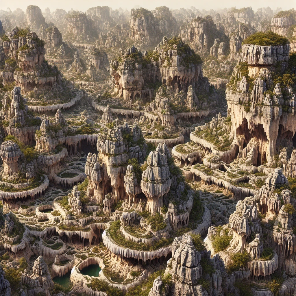
Karst topography is a unique landscape shaped by the dissolution of soluble rocks, such as limestone, dolomite, and gypsum. This natural process gives rise to fascinating landforms, including sinkholes, caves, and underground rivers. The term ‘karst’ originated from a region in Slovenia, where such features were first studied. These landscapes are known for their distinctive features and are important for understanding groundwater systems and erosion patterns. This geological phenomenon occurs worldwide and is driven by the interaction between water and rock. The process involves both erosion and deposition. Water seeps through cracks in the rock, slowly dissolving it over time. The result is a visually striking landscape filled with various landforms. Below are some key points related to karst topography:
- Karst topography features include caves, sinkholes, and springs formed by rock dissolution.
- The presence of soluble rocks like limestone is essential for karst topography formation.
- Karst landscapes support unique ecosystems due to the underground water systems they develop.
What is Karst Topography?
What is karst topography? It is a landform developed due to the chemical weathering of soluble rocks, primarily by water. The landscapes are formed through a slow but continuous process of rock dissolution, primarily of limestone, gypsum, or dolomite. Water rich in carbon dioxide reacts with these rocks, causing them to erode and create fascinating underground systems and surface features.
This type of landscape is essential for various ecosystems and serves as a vital water source in many regions. The groundwater flow in karst topography features forms complex cave systems that are important for biodiversity and water resources.
Karst Topography Formation
Karst topography formation occurs when water, often containing carbon dioxide, reacts with the soluble rock and causes it to dissolve. Over time, the dissolved rock creates features like caves and sinkholes. The formation process involves the following:
Chemical Weathering of Limestone
Karst topography primarily forms through the process of chemical weathering, where rainwater absorbs carbon dioxide from the atmosphere and soil, forming a weak carbonic acid. This acid reacts with calcium carbonate (limestone), slowly dissolving it over time, creating cavities and fissures.
Development of Joints and Fissures
Over time, the dissolution process enlarges natural cracks and joints in the limestone. These fissures allow water to penetrate deeper into the bedrock, accelerating the dissolution process and forming extensive underground networks.
Sinkhole Formation (Dolines)
The surface layer collapses into voids created by the dissolution of limestone beneath, forming sinkholes or dolines. These can be shallow or deep depressions, sometimes filled with water, and are a common feature in karst landscapes.
Formation of Underground Caves and Caverns
As water continues to erode limestone along cracks, large underground chambers, known as caves or caverns, form. Over time, these can become vast systems with intricate passageways, featuring formations like stalactites (hanging from the ceiling) and stalagmites (rising from the floor).
Creation of Disappearing Streams
In karst regions, surface streams often disappear into sinkholes, traveling underground through limestone passages and sometimes reappearing elsewhere as springs. This subterranean drainage system is a hallmark of karst topography.
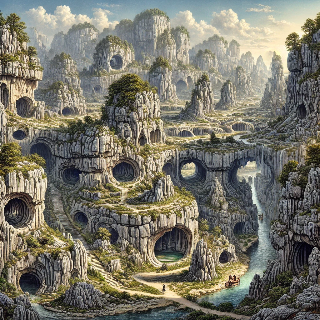
Formation of Natural Bridges
In some cases, as limestone is eroded from below, the roof of a cave or tunnel may collapse, leaving natural bridges of rock across valleys. These formations are the result of continued dissolution and surface erosion.
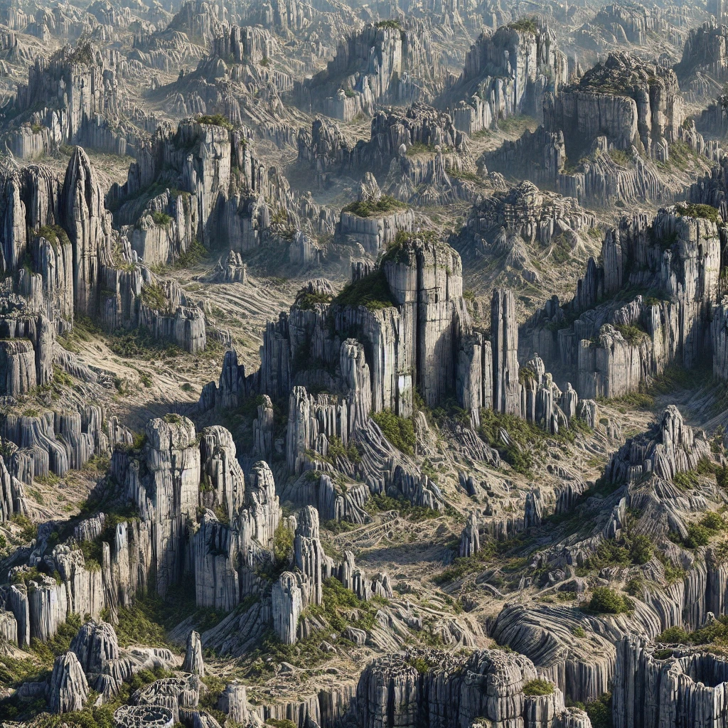
Karst Towers and Pinnacles
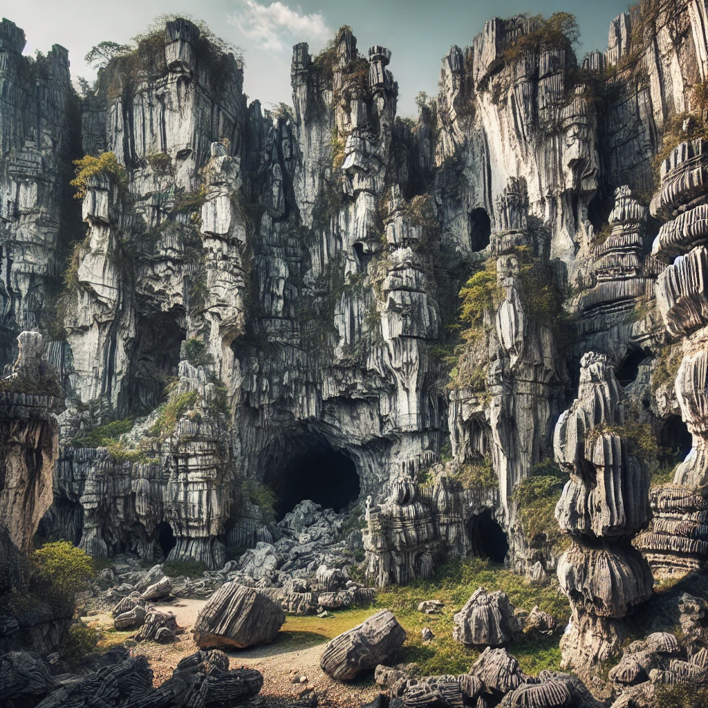
In more advanced stages of karst formation, tall, steep-sided limestone towers or pinnacles may be left standing as the surrounding rock is dissolved away. These dramatic features are found in tropical karst regions, such as in parts of China and Southeast Asia.
Sinkhole Lakes and Poljes
Larger sinkholes or dolines may fill with water to form sinkhole lakes. In some cases, large flat-floored depressions called poljes develop, which can span several kilometers and are often seasonally flooded, creating unique ecosystems.
Karst Springs
As water travels through underground karst systems, it may emerge at the surface as springs. These springs often have high discharge rates, especially after heavy rainfall, and are crucial to the hydrology of karst regions.
Speleothems Formation
Inside caves, as mineral-rich water drips from the ceiling, it leaves behind deposits of calcium carbonate, gradually forming speleothems like stalactites and stalagmites. These formations grow slowly over thousands of years and contribute to the complexity of karst cave systems.
Karst Topography Features
Karst topography features are mainly underground caves, sinkholes, springs, and disappearing streams. These features are not only fascinating to observe but also offer insight into natural processes of erosion and weathering. Caves, which are one of the most common landforms in karst topography, form as water continuously dissolves the limestone.
Sinkholes (Dolines)
Sinkholes are depressions or holes in the ground formed by the collapse of a surface layer into voids created by limestone dissolution. These can range from small pits to large basins and are characteristic of karst landscapes. They form through either gradual erosion or sudden collapse, often revealing underground drainage systems.
Caves and Caverns
Caves and caverns are large underground spaces formed through the chemical dissolution of limestone. These hollow voids may extend for kilometers, featuring intricate networks of tunnels, chambers, and formations like stalactites and stalagmites, created by dripping mineral-rich water. They offer valuable insights into geology, hydrology, and speleothem growth.
Stalactites and Stalagmites
They are mineral formations found in caves, created by the deposition of calcium carbonate from dripping water. Stalactites hang from the cave ceiling, while stalagmites rise from the ground. Over time, they may join to form columns, adding to the intricate beauty of karst cave systems and representing slow geological processes.
Disappearing Streams
Disappearing streams, also called sinking streams, occur when surface water flows into sinkholes, disappearing into underground channels rather than continuing above ground. These streams are characteristic of karst regions, where surface water erodes limestone to form subterranean drainage systems, contributing to the area’s unique hydrology and influencing groundwater flow.
Karst Springs
Karst springs occur when underground water resurfaces, emerging from caves or fissures after traveling through limestone channels. These springs often have high water discharge rates and play a significant role in the hydrology of karst regions. The water’s path from surface to spring highlights the interconnectedness of subterranean and surface drainage systems.
Poljes
Poljes are large, flat-floored depressions found in karst landscapes, typically several kilometers in length and width. They are formed by the dissolution of limestone and are often subject to seasonal flooding. These fertile areas are significant for agriculture, as they collect water and sediments, creating rich soil for farming, despite their vulnerability to waterlogging.
Limestone Pavements
Limestone pavements are flat, exposed surfaces of limestone characterized by deep cracks, known as grikes, and blocks called clints. They form as rainwater, mixed with carbon dioxide, dissolves the surface of the limestone along natural joints. The result is a distinctive, often jagged landscape, commonly found in temperate karst regions, like those in the UK and Ireland.
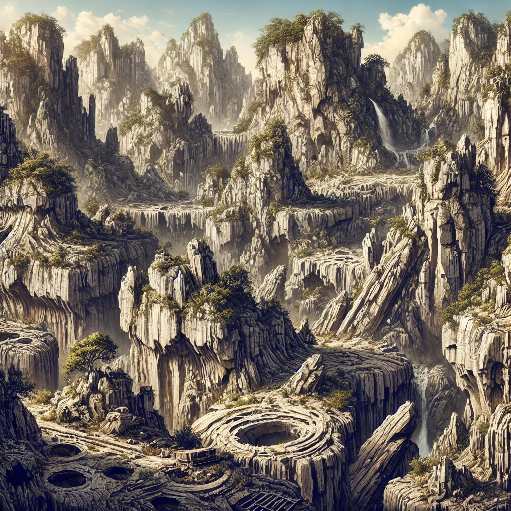
Karst Topography Landforms
The most notable karst topography landforms include caves, sinkholes, and springs. These landscapes also contain underground rivers, which contribute to groundwater flow and storage. Karst topography landforms result from water moving through the ground, creating unique geological formations that are both beautiful and scientifically significant.
- Caves: Underground systems formed by rock dissolution.
- Sinkholes: Depressions or holes formed due to collapsed rock layers.
- Springs: Points where groundwater emerges naturally at the surface.
Karst Topography Depositional Landforms
| Landform | Description |
|---|---|
| Stalagmites | Formations that grow upwards from the floor of a cave due to the deposition of minerals from dripping water. |
| Stalactites | Icicle-shaped formations hanging from the ceiling of a cave, created by the deposition of minerals from dripping water. |
| Flowstones | Sheets or curtains of mineral deposits formed on cave floors or walls, created by flowing water. |
| Soda Straws | Thin, hollow mineral formations that are precursors to stalactites, formed by dripping water. |
| Column | A combined stalactite and stalagmite that meet, forming a vertical column in a cave. |
| Helictites | Unusual, twisted formations in caves, growing in various directions, often in response to air currents. |
| Cave Pearls | Small, round, concentric mineral formations found in cave pools, formed by the accumulation of mineral deposits around a nucleus. |
| Tufa | Porous, light, and often fibrous mineral deposits formed by the precipitation of calcium carbonate from flowing water. |
Karst Topography Erosional Landforms
| Landform | Description |
|---|---|
| Sinkholes (Dolines) | Natural underground voids are formed by the dissolution of soluble rocks like limestone. |
| Caves | Natural underground voids formed by the dissolution of soluble rocks like limestone. |
| Karst Valleys | Deep, narrow valleys formed by the dissolution of soluble rock and the subsequent erosion by surface water. |
| Limestone Pavements | Flat, exposed rock surfaces with distinct patterns of erosion, often found in karst landscapes. |
| Uvalas | Large depressions or valley-like features formed by the coalescence of multiple sinkholes. |
| Cockpits | A type of karst depression characterized by a series of small, rounded depressions, often with steep walls. |
| Karst Towers | Isolated, steep-sided hills or mountains that remain after surrounding rock has been eroded away. |
| Poljes | Large, flat-floored depressions or plains in karst regions, often filled with sediment and formed by extensive erosion. |
Conditions for Karst Topography Formation
Several conditions are necessary for karst topography formation. Firstly, the presence of soluble rocks such as limestone is crucial. Secondly, water plays a key role in eroding the rocks. A humid climate accelerates the process, while the presence of carbon dioxide in water enhances the dissolution.
Presence of Soluble Rock
Karst topography primarily forms in regions with soluble rocks like limestone, dolomite, or gypsum. These rocks can easily dissolve when exposed to slightly acidic water, such as rainwater mixed with carbon dioxide, allowing for the formation of underground drainage systems, sinkholes, caves, and other karst features.
Abundant Water Supply
A consistent supply of water, typically from rainfall, is crucial for the formation of karst topography. Water absorbs carbon dioxide from the atmosphere and soil, forming carbonic acid, which dissolves the soluble rock over time. This water flow facilitates the development of underground passages and karst features.
Fractured or Jointed Rock Structure
The presence of cracks, joints, and fissures in the soluble rock enhances water infiltration. These natural weaknesses in the rock allow water to penetrate deeper, speeding up the dissolution process and leading to the formation of underground caves, sinkholes, and other karst features.
Long Period of Geological Time
The formation of karst topography requires an extended period of geological time. The slow process of rock dissolution and the creation of karst features, such as caves and sinkholes, can take millions of years to fully develop, allowing the landscape to evolve.
High Carbon Dioxide Content in Soil and Water
High levels of carbon dioxide in the soil and water contribute to the formation of carbonic acid, which is essential for dissolving the limestone or other soluble rocks. This high concentration of CO2 typically comes from decaying organic matter in the soil, facilitating the chemical weathering process.
Well-Drained Landscape
A region with minimal surface water and a high degree of groundwater drainage encourages karst formation. As rainwater and surface streams sink into the ground, they dissolve the underlying rock, creating subterranean channels and features, such as caves and underground rivers, which are key characteristics of karst topography.
Karst Topography in India
| Location | Description |
|---|---|
| Mawsmai Caves, Meghalaya | A network of caves with impressive limestone formations, including stalactites and stalagmites. |
| Siju Caves, Meghalaya | Known for their extensive cave system and rich karst formations. |
| Liat Prah Caves, Meghalaya | Famous for their long caves and unique karst landscapes. |
| Borra Caves, Andhra Pradesh | Caves with extensive stalactite and stalagmite formations, located in the Ananthagiri Hills. |
| Elephanta Caves, Maharashtra | Caves with rock-cut temples and some karst features, though primarily known for their historical significance. |
| Badami Caves, Karnataka | Ancient rock-cut temples with some karst features in the surrounding landscape. |
| Krem Liat Prah, Meghalaya | One of the longest caves in India, known for its diverse karst features. |
| Krem Mawmluh, Meghalaya | Noted for its impressive length and complex cave system. |
| Shillong Plateau, Meghalaya | Features various karst formations including caves and gorges. |
Karst Topography Distribution Across the World
| Region | Notable Features |
|---|---|
| China | Guilin and Yangshuo Karst: Famous for dramatic limestone peaks and karst hills. |
| USA | Shenandoah Valley, Virginia: Features numerous caves and sinkholes. |
| Europe | Karst Region, Slovenia and Croatia: Known for extensive cave systems and unique karst landforms. |
| Australia | Nullarbor Plain: Noted for its extensive cave systems and karst formations. |
| Mexico | Yucatán Peninsula: Features cenotes and extensive cave systems. |
| Malaysia | Gunung Mulu National Park: Famous for its large cave systems and karst towers. |
| Vietnam | Phong Nha-Kẻ Bàng National Park: Known for its extensive cave systems and karst landscapes. |
| Thailand | Chiang Mai Province: Notable for its unique karst formations and caves. |
| Philippines | Chocolate Hills, Bohol: Characterized by its conical karst hills. |
| India | Meghalaya Caves: Known for extensive cave systems and unique karst features. |
Conclusion
Karst topography is a fascinating landscape shaped by the dissolution of soluble rocks, forming unique landforms like caves, sinkholes, and springs. It plays an essential role in groundwater systems and supports diverse ecosystems. With its presence in regions across the globe, including karst topography in India, these landscapes continue to capture the imagination of geologists and nature enthusiasts alike. Understanding karst topography formation and the conditions required for its development offers valuable insights into the processes of erosion and weathering that shape our planet.
| Karst Topography UPSC Notes |
| 1, Karst topography forms in regions with soluble rocks like limestone, resulting in distinctive landforms due to chemical weathering and erosion. 2. Common karst features include caves, sinkholes, and underground rivers, created by rock dissolution over time. 3. Stalagmites and stalactites are typical cave formations resulting from mineral deposits left by water in karst environments. 4. Karst valleys are deep, narrow depressions carved by the dissolution of soluble rock and erosion from surface water. 5. Limestone pavements display flat, eroded rock surfaces with characteristic patterns, often found in karst regions. 6. Karst towers are steep-sided hills or isolated peaks formed after the surrounding soluble rock is eroded. 7. Uvalas are large depressions or valleys formed by the merging of multiple sinkholes, creating extensive karst landscapes. 8. Global examples of karst topography include the Guilin region in China, the Nullarbor Plain in Australia, and the Yucatán Peninsula in Mexico. |